ACADIA NATIONAL PARK
BAR HARBOR, MAINE: Visited October 2023
Acadia National Park was established in 1919. The National Park is about 80 square miles which is mostly on an island off the coast of Maine. The park offers a huge variety of landscapes, wildlife, and glacier cut mountains, the tallest on the east coast being Cadillac Mountain. There are beaches, forests, lakes, and the charming town of Bar Harbor on this beautiful little island. There is a large variety of hiking, from easy walking paths to technical, vertical climbs. All in all, Acadia National Park is one of a kind! I would suggest going in the fall like we did to see the amazing colors!
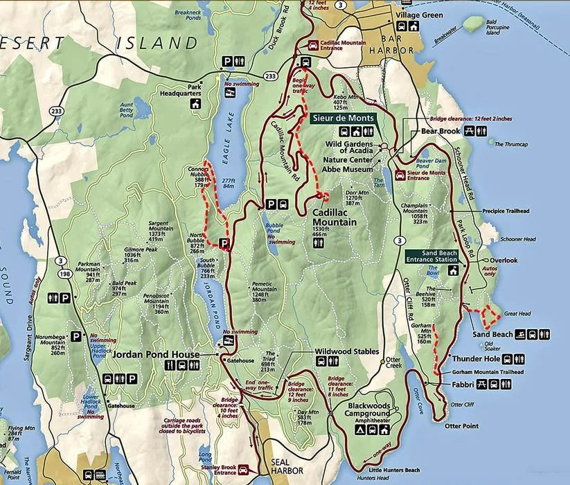
PARK LOOP ROAD
Acadia has a loop road going from the visitors center all around the park, past the main sites and trailheads. Majority of the road is one way, so once you are on it, if you miss a turn or a parking area, it will be about 30-45 minutes before you can come back around to it again. This is important to keep in mind because this park is BUSY! There are tons of trails to hike and things to see, but VERY limited parking. It was quite frustrating to be honest. I will talk about the “parking issues” we ran into for each hike down below. The more you know, the better chance you’ll have of finding a spot!


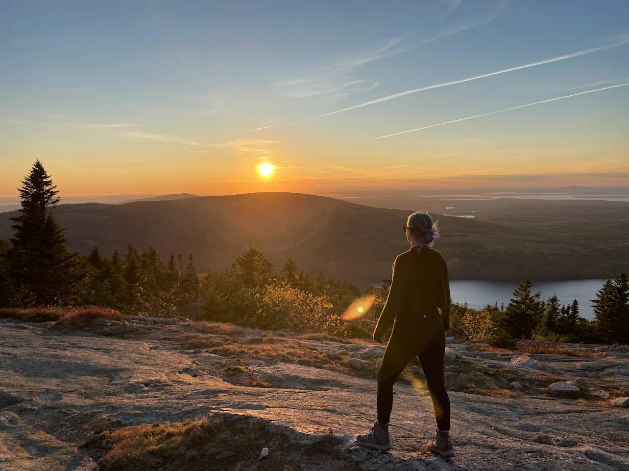
CADILLAC MOUNTAIN DRIVE

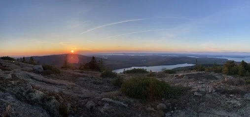
Cadillac Mountain is one of the main attractions in Acadia. Although you can hike it (2.1 miles one way, 1,200 ft elevation gain), we chose not to due to parking being full by 4:30am!
We decided instead to drive up to the submit for the sunset. You will need to make a reservation if you want to drive on Cadillac Mountain at all. I would recommend a couple weeks in advance!
But watching the sunset at the summit was AMAZING. You could see the whole park. At the summit, there are a couple of small trails, as well as a gift shop and some facilities.

SAND BEACH

Ocean Beach is right off of the Beehive Summit Trailhead parking lot. The beach is windy and the water is VERY cold. I do not recommend swimming! But it was nice touch the ocean! The area also has facilities.
This parking lot is VERY small, and you just have to be lucky enough to pull in as someone is leaving. This was one of the most popular parking lots and only had about 30 spots.
THUNDER HOLE
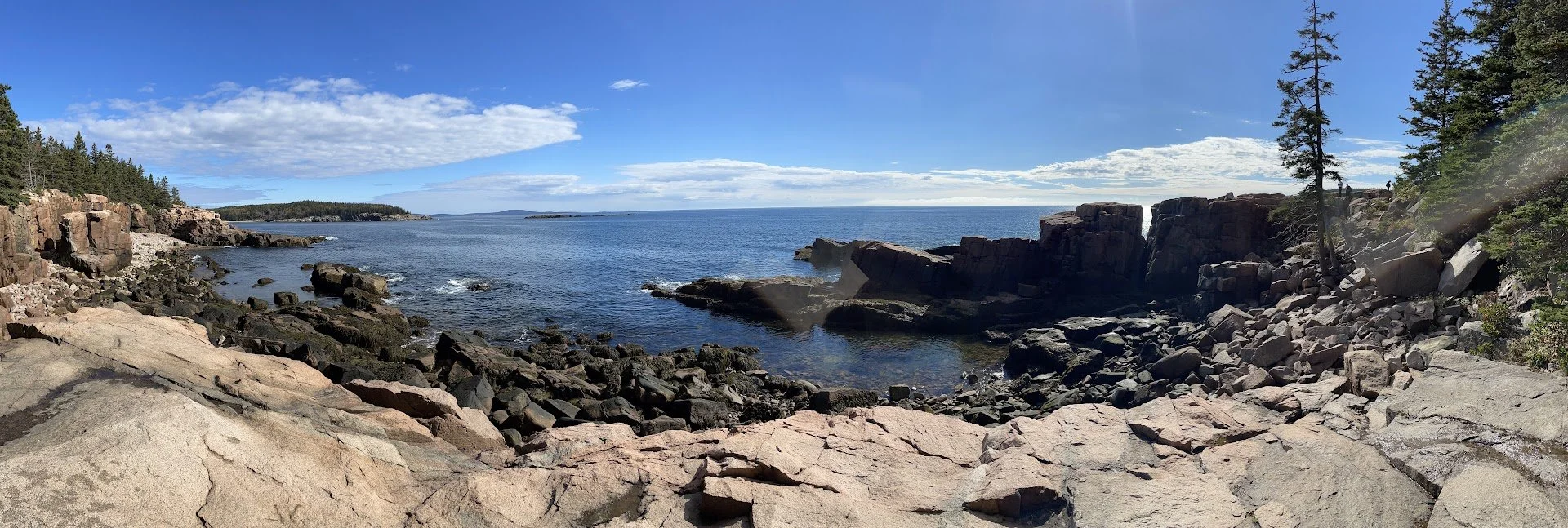
Thunder hole is just a mile or so south of Sand Beach on the park loop road. It is named because of a rock inlet that makes a thunderous “boom” when the waves come crashing through.
This parking lot was also quite small, but, there was street parking as well. This is also just a get out and back in the car kind of stop. So people are coming and going much more frequently.


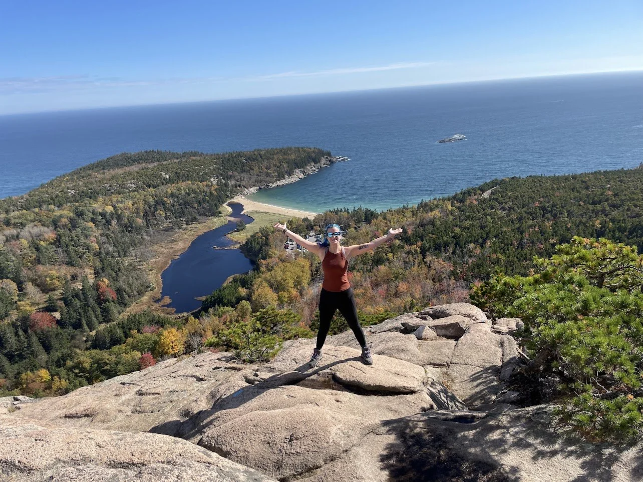
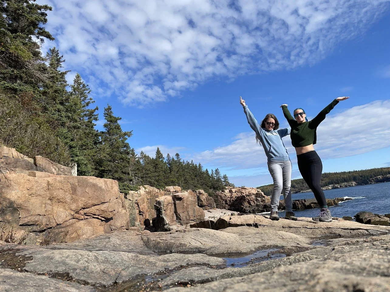
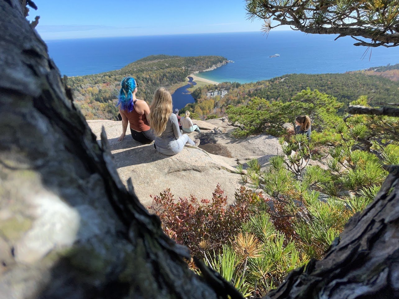
BEEHIVE LOOP
Distance: 1.4 miles (one way) Elevation Gain: 450 ft Hiking time: 1 hour
This hike is one of the most amazing hike I have ever done! It is not for the faint of heart who have a fear of heights. The elevation gain is quick at the beginning as you walk through the woods.
Eventually, you will come to climbing bars where you will ascend vertically. Although there are no severe drops (unlike Precipice Trail), it can still be a little nerve racking for those who are afraid of heights or have unsure footing/ footwear.
Overall though, I thought it was an absolute blast. And the view was 1000% worth it!
To get to this hike, we parked in the same parking lot for Sand Beach.


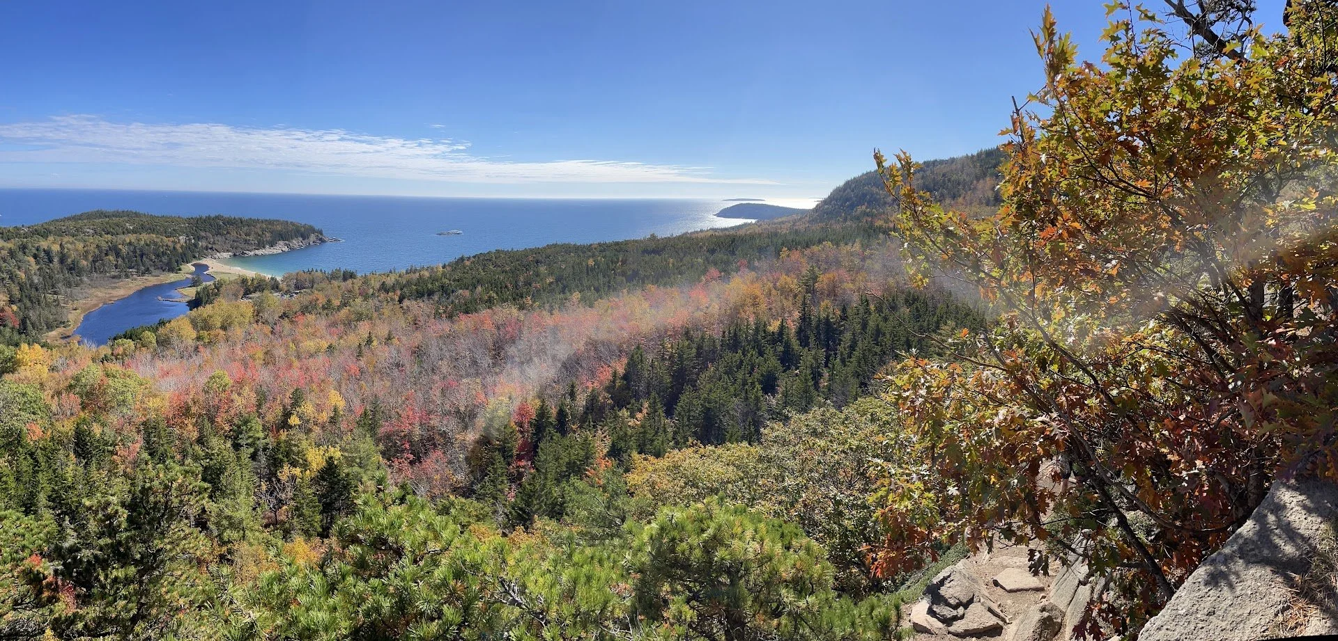
BEEHIVE LOOP, GORHAM MOUNTAIN, OCEAN PATH
Distance: 3.85 miles (roundtrip) Elevation Gain: 1,046 ft Hiking time: 2.5 hours


Once you reach the top of Beehive, you have a choice to take the short trail down (though you cannot go back the way you came because of the vertical climbs), or the long trail down.
We decided to take the long way to Gorham Mt. It wasn’t too difficult, mostly just walking through the beautiful forest before ascending to the mountain peak for beautiful views of the colorful leaves and trees below!
Once you are at the bottom, you will end at Thunder Hole and walk the Ocean Path Trail back to the parking lot. This trail is about a mile of an easy, flat, dirt packed path along the ocean cliffs.


JORDAN POND LOOP
Distance: 3.7 miles (round trip) Elevation Gain: 52 ft Hiking time: 1.5 hours

This trail is very very easy with almost no elevation gain. We chose to do it at as our night hike. Acadia is known for being a great park to go star gazing. We were unlucky and chose a cloudy night! Put this path around the pong is either paved or board walked the whole way around.
We also chose to do it at night because this parking lot was IMPOSSIBLE during the day. This is one of the view “accessible” hikes in the park so the older population tends to be here. There is also a restaurant as well. Meaning once this parking lot fills up, people aren’t leaving soon.


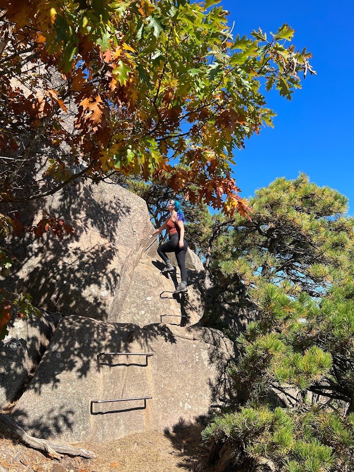
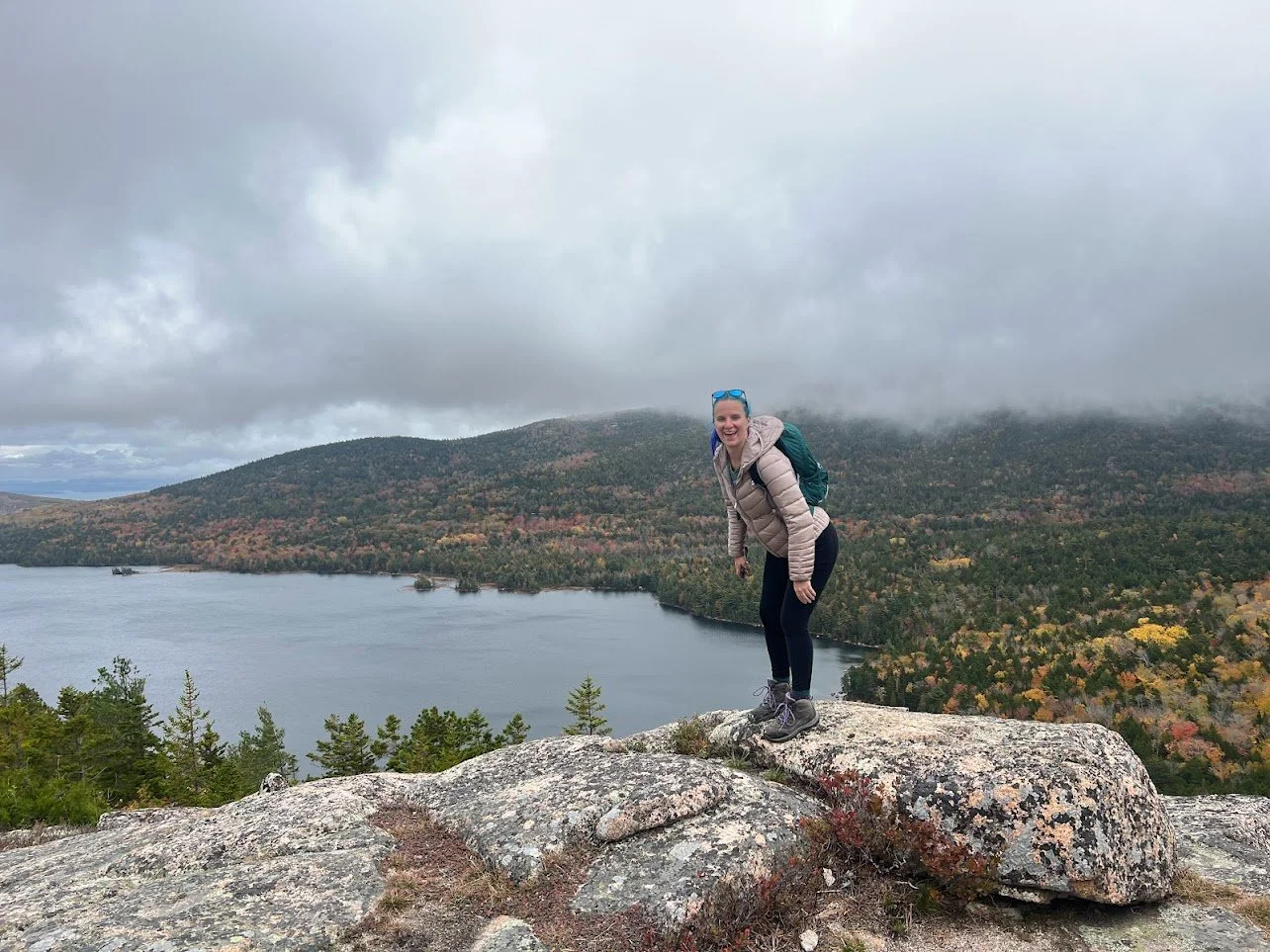
THE BUBBLES (NORTH BUBBLE)
Distance: .7 miles (one way) Elevation Gain: 550 ft Estimate Time: 45 minutes

The Bubble’s hike was a challenging hike with alot of elevation gain over a short period of time. However, it was nice to have the over look to Jordan Pond so we could see where we had hiked the night before!
This parking lot has only 10 spots! I honestly don’t know how we got so lucky parking here.


NORTH BUBBLE, CORNER NUBBLE, EAGLE LAKE LOOP
Distance: 4.1 miles (roundtrip) Elevation Gain: 805 ft Hiking time: 3 hours
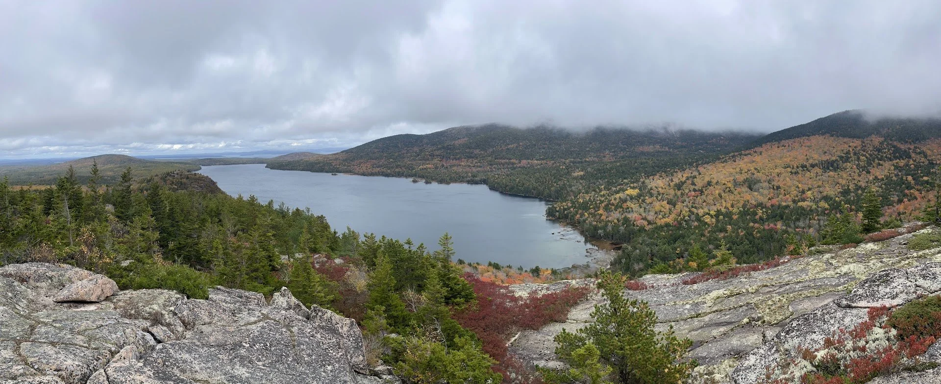
Once you hike to the North Bubble, you can chose to turn around, or do a loop and continue to the Corner Nubble and Eagle Lake.
I am so glad we did! There was almost no one past the North Bubble and we found this INCREDIBLE overlook. The changing colors of the leaves and the rocky mountains made for some amazing views.
The hike to Corner Nubble was definitely exhausting, but once you get to the bottom of Eagle Lake, it is a flat 2 mile walk back to the parking lot.


PRECIPICE HIKE
Distance: .9 miles (one way) Elevation Gain: 1,060ft Hiking Time: 1 hour
PRECIPICE/ CHAMPLAIN MOUNTAIN/ ORANGE AND BLACK LOOP
Distance: 2.6 miles (roundtrip) Elevation Gain: 1,123 ft Hiking time: 2 hours+
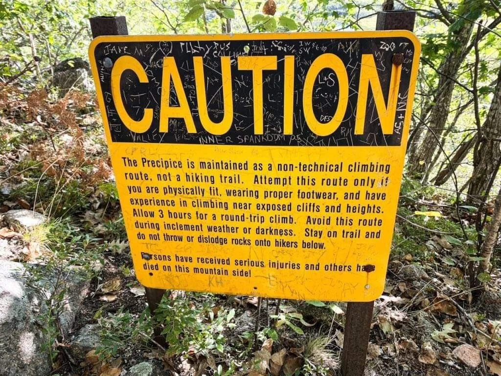
CAUTION: DO NOT do what we did on this hike. We broke the rules (unintentionally) and found ourselves in a fairly dangerous situation.
This hike is similar to Beehive with the climbing rails HOWEVER, where it has vertical climbs, if you misstep, let go, or slip, you WILL fall. And you will fall far.
Do not take this hike lightly.
There is no parking lot for this hike. Similar to Cadillac Mt Trail, you park on the road (the indicate where you can and can’t park) and walk to the trailhead.

All that being said, this hike was right up my alley as and adrenaline rush. I am not really afraid of heights and I trust my abilities fairly well. But this is the first hike that scared me. Mostly because I felt like I had to take care of my buddy as well as myself.
This was our last and final hike of the trip. We did it late in the afternoon, (after filling up on lobster and old fashions) assuming we would have enough time. However, a storm we did not anticipate rolled in. Which meant not only did we get about halfway up when it started to rain, but it also got dark FAST.
This hike is a one way in that once you reach the vertical spots, it is too dangerous to turn around. The only way is up. It starts out with some basic rock scrambling with a couple of mild vertical climbs (to make sure you are comfortable with it before being 1000ft off the ground). The beginning was not very treacherous, but we were still standing on the edge of a cliff.


Once we were about 500ft up and .5 miles in, the darkness and rain rolled in and the danger started to set in.
Majority of the hike the rest of the way up is holding on the climber rungs while dangling off the sides of the mountain. There a couple of mild resting spots, but you start to go up pretty fast.
Doing this in the rain is particularly dangerous because the rungs and the rocks become slippery. There are some part where you are shimming on a slopped rock only about 8 inches wide while holding onto the rungs.
Even during the day, I could see this hike being daunting. Especially if you have slow moving hikers in front of you and you have just….. “hang on” while you wait.


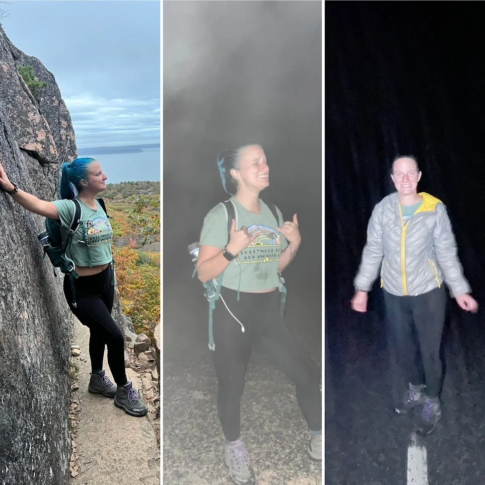
Once we FINALLY reached the top, the scary part was over, but the hard part was not. We still had to get back down to our car and we couldn’t go the way we came.
The hike ends at the top of Champlain Mt. obviously I can’t speak to the views since it was pitch black by the time we got to the top, but I am sure they are great!
The decent down was slow going because of the rain. The path is marked with blue spray paint strips. It was like playing hide a seek with our flashlights to find the next mark. I am sure it is much easier during the day. Eventually you meet up with Orange and Black Trail when you are at the bottom of Champlain Mt. This trail will take you back to the road. It was a short walk back to our car from there!
These picture are a great representation of “ How it Started”, “Finally Reaching the Top”, and “How it Ended”.


Overall, Acadia National Park is the best park in the East Region I have been to. It had some of the best trails I have ever done. The scenery in the fall was drop dead gorgeous and aw inspiring.
The town of Bar Harbor where we stayed was a perfect little (touristy) town which added to the feel of a adventurous vacation. If you come here, do all the hikes you can, eat lobster, and take lots of pictures!